Maps
Note:
The maps, presented in their original French version, are available in JPEG and PDF format, they are regrouped by country or theme:
[Southeast Asia] - [Malaysia] - [Vietnam] - [Airline services]
Click on a thumbnail to view a large version in JPEG format, or click on the appropriate icon to view a PDF (Acrobat) or EPS version.
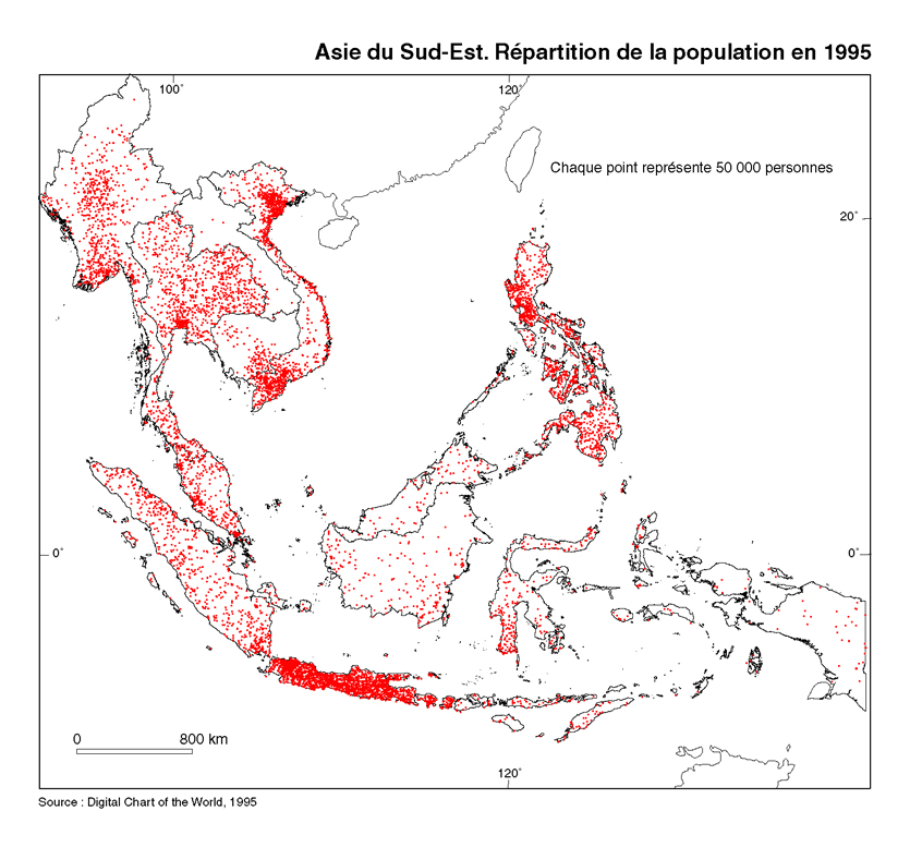
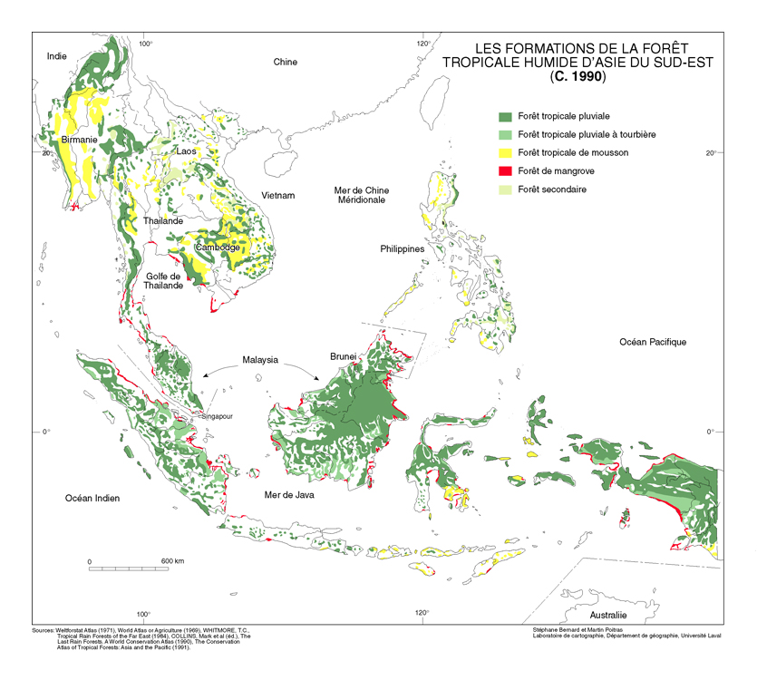
Southeast Asia
Published in Mappemonde. (#71, 2003.3)
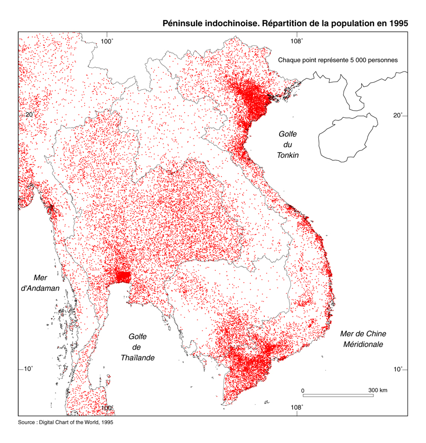
Source: Digital Chart of the World.
To be published in Mappemonde.
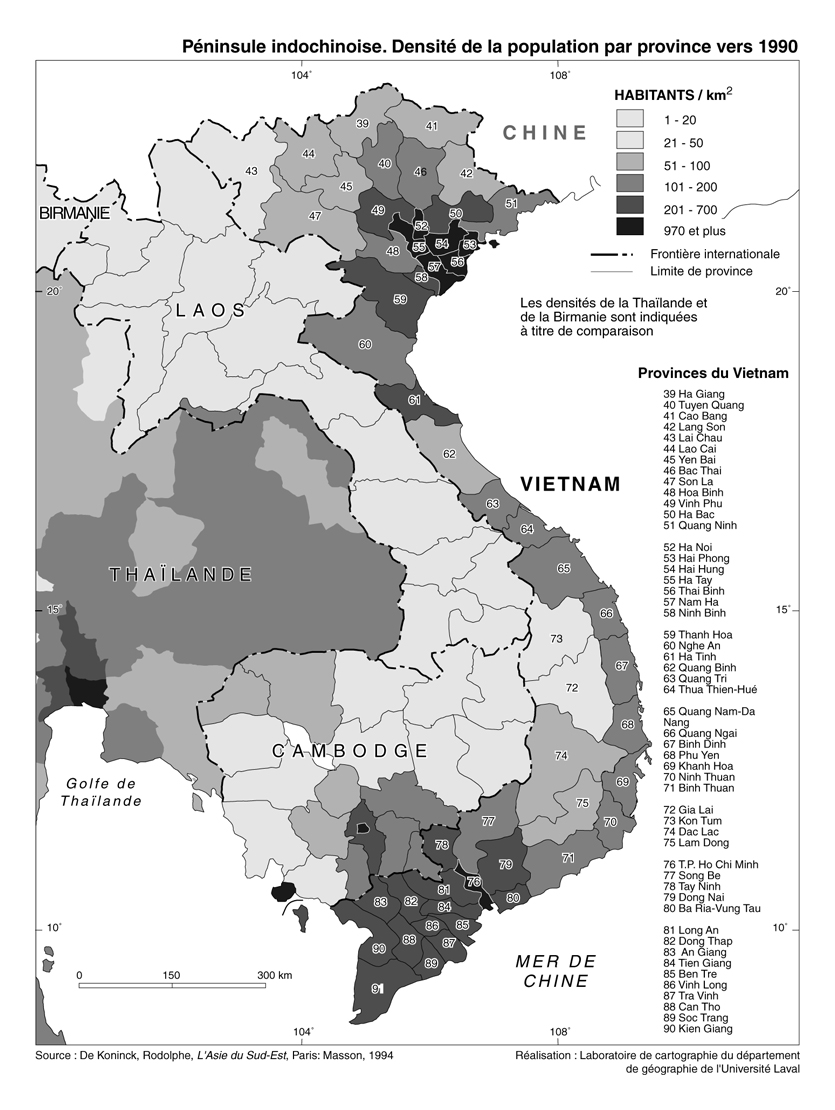
Source: Rodolphe De Koninck, L'Asie du Sud-Est, Masson (1992).
Production: Stéphane Bernard, Martin Poitras, mapping laboratory of the Université Laval.
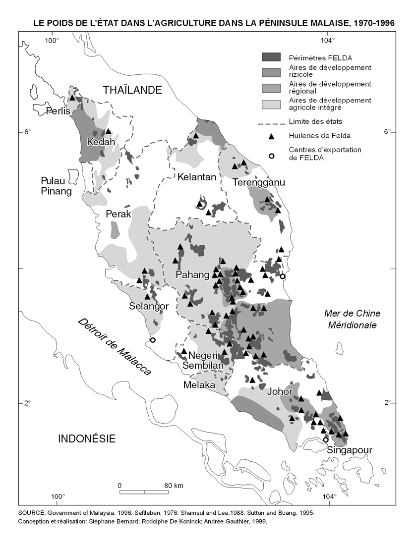
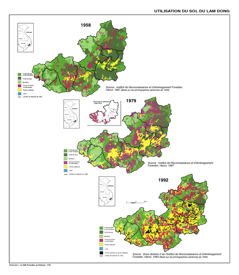
Malaysia Vietnam
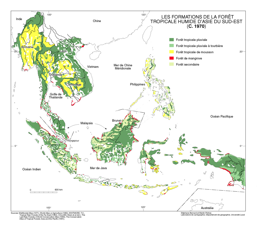
Production: Stéphane Bernard, Rodolphe De Koninck, Andrée Gauthier.
Production:: Le Défi Forestier au Vietnam, 1996
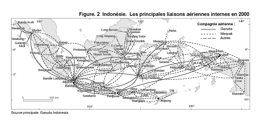
Airline services
Source: Garuda Indonésia.